The Wash Estuary is one of the most remarkable landscapes in Britain, yet it remains surprisingly little known even among many of the people who live around it. A vast estuary stretching between the Lincolnshire coast and West Norfolk, it is a place shaped by water, tides, geology, human endeavour and constant change.
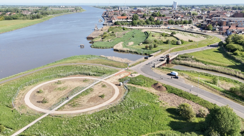
Historically washes were pasture lands subject to flooding in winter and there used to be many in the Fens. Now, the term also applies to drainage systems which are often adjacent to rivers. We have the Ouse Washes, a 20 mile long drainage channel controlled with sluices and pumping stations, spanning the Fens from Cambridgeshire to Norfolk, and originally part of the 6,000 acre flood defence drainage systems with which Dutch engineer Cornelius Vermuyden was associated in the mid 17th century.
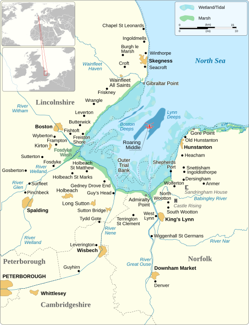
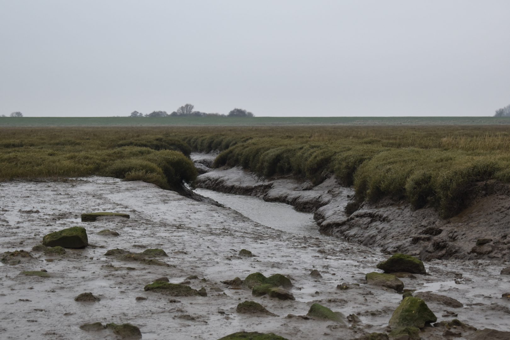
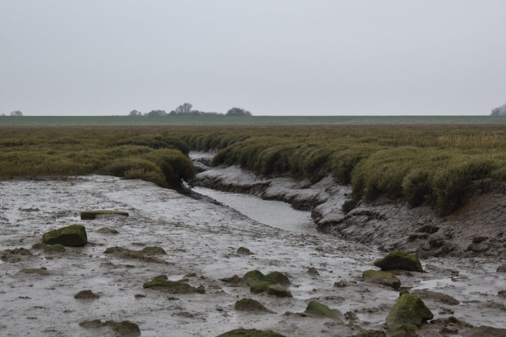
There is however, only one ‘internationally recognised geographical location’ commonly referred to as ‘The Wash’. As the largest estuary system in the United Kingdom, it occupies a 237 square mile swathe of coastline extending from Skegness and Gibraltar Point on the Lincolnshire coast, over to Hunstanton and Gore Point on the coast of West Norfolk. A huge bay fed by five major rivers, it is remarkable for its globally important extensive edge landscapes ranging from mudflats, sandbanks, dunes and wide sandy beaches to extensive salt marsh and farmland extending inland. The Wash has provided bounty. Its rivers used to carry trade bound for the Netherlands and Baltic, and be brimming with pike, bream and especially eels; the sea carrying herring, flounders and especially shellfish. It still hosts a moderate fishing industry and some trade in timber and agricultural produce.
A landscape shaped by deep time
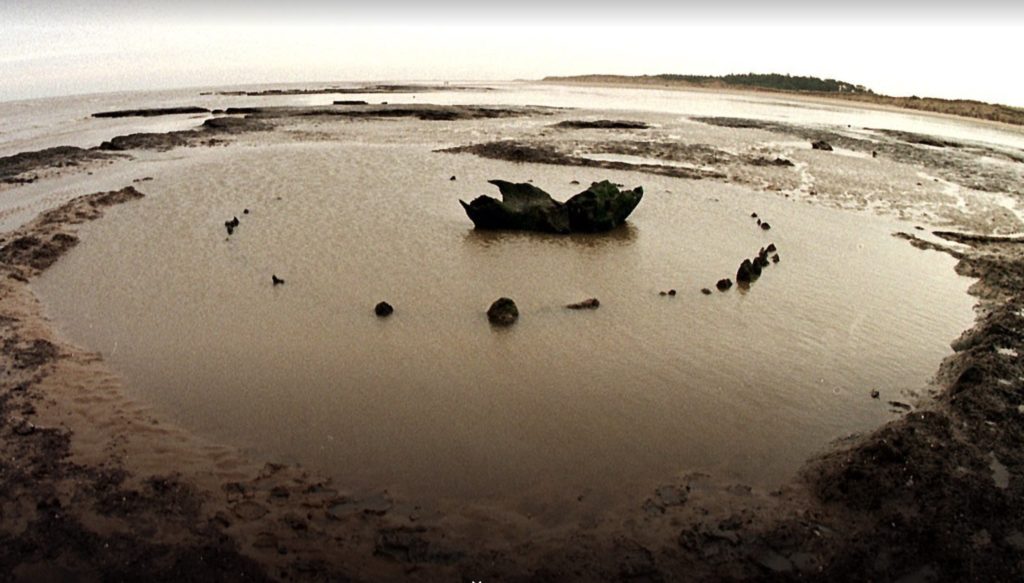
To understand The Wash is to recognise that coastlines are never permanent. They move, disappear and reform over centuries and millennia. Research by historian Caitlin Green traced its development on the East Lincolnshire coast since prehistory. Initially, over the thousands of years’ course of the Middle Stone Age, c.15,000 – 2,500 BCE, there was no coastline at all – as following the end of the Ice Age, Norfolk and Lincolnshire were both connected to the Continent of Europe by a substantially forested landmass known as Doggerland. Then from around 6-7000 BCE as the sea levels began to rise, a deeper channel gradually formed to create the beginnings of the estuary. Originally intertidal islands protected the Lincolnshire coast from the worst storms, until these were drowned, probably in the late 13th century. On the NW coast of Norfolk one important monument has survived from the Bronze Age. Dating from c. 2500 BC, ‘Seahenge’, or Holme II was revealed by the sea in 1998 at low tide. A circle of timber posts around an upturned oak and constructed originally on land, it was undoubtedly made as an important place of ritual. Its survival and rediscovery remind us that the landscape we know today is only one moment in a much longer story. The Wash is therefore not simply a place to be protected or preserved It is a place to be understood as dynamic, where cultural and natural change is part of its identity
A landscape of extraordinary life
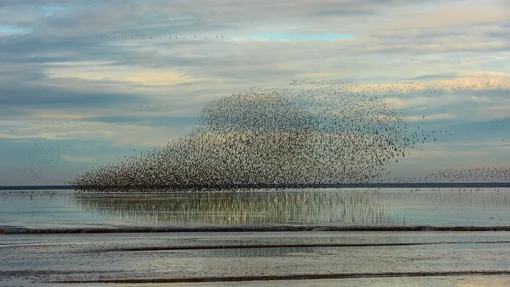
Over the coastal hinterland of the Wash one can see for miles and miles over open country. At first glance, this very openness can make it appear empty. The horizon is wide, the land is flat and settlements are scattered. It is on looking up, however, one realises that this is where the largest population lives, as the sky hosts many, many birds Hundreds of thousands of migrating birds pass through the region each year, making use of its internationally important habitats. The salt marshes, mudflats and wetlands support huge numbers of waterbirds and provide essential feeding and resting grounds. So significant is this entire area as a habitat, supporting 17 species of international importance, that it is on track to be designated a United Nations World Heritage site, known as the East Coast Flyway and extending all the way from the Humber to the Thames estuary.
The importance of this environment is recognised internationally. The Wash forms part of a wider network of protected habitats supporting species of global significance, and there are ambitions to achieve greater recognition for the region’s natural and cultural importance.
One might expect such an extraordinary place to be widely celebrated. Yet this is not always the case.
Who knows The Wash?
One would think that a place as extensive and unique as the Wash would be known and celebrated as such. But that seems to be far from being the case. The RSPB recently conducted some vox-pop research at a supermarket in Boston, Lincolnshire, one of the main towns of The Wash, and discovered that while older people did know it, reminiscing about excursions, picnics and fishing expeditions, virtually no-one under the age of 40 knew what ‘The Wash’ was. For them, it was a dull place with little to offer in terms either of entertainment or employment. Subsequently, RSPB’s community research has revealed wide awareness of the potential of the beauty and rarity of the Wash, but that it is under-exploited, both culturally and economically. So, a big question is emerging:
‘How can we all work together to create more opportunity for a thriving local society, while also gaining greater recognition for its special qualities as one of the UK’s prize areas of nature and rural life?’
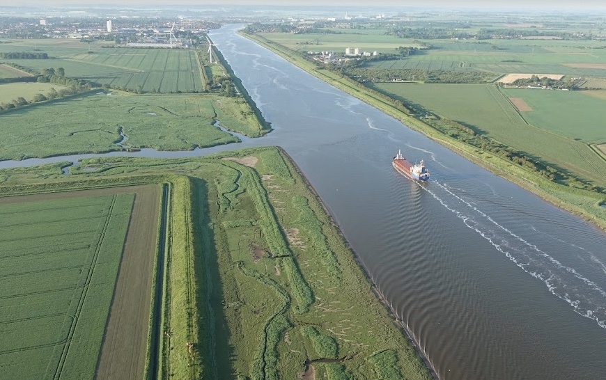
This is where GroundWork Gallery believes creativity has an important role to play. For ten years, GroundWork has explored relationships between art, materials and the environment. Through exhibitions and its artist residency programme, the gallery has brought artists into dialogue with landscapes, resources and communities. The next stage of this work focuses on The Wash—not as a backdrop for artistic activity, but as a complex living environment requiring imagination, conversation and care. The future of The Wash will inevitably involve difficult choices. And as Antarctic ice sheets become more unstable and sea levels are expected to rise globally, we are increasingly subject to the vagaries of climate change, and there are growing concerns over the future of this low-lying landscape, about adaptation, protection and how communities live with water. The Wash is entering a period where major decisions about its future are being considered. This is precisely the moment when cultural voices, local communities and artists need to be part of the conversation.
Learning from other landscapes
The future of The Wash is not an isolated question. Around the world, low-lying coastal landscapes are facing increasingly urgent decisions about how to live with rising seas and changing climates.
The Netherlands offers a particularly important comparison.
As a nation built on land which is largely below sea level, the Dutch are once again leading the way in designing options for innovative engineering solutions to sea level rise. Their Delta region on the SE Netherlands coast, which includes the Waddensee, an extensive area already with its United Nations World Heritage designation for nature, is a much more industrial and highly populated counterpart to the Wash. Indeed this region, incorporating both Amsterdam and Rotterdam, is home to 60% of the Dutch population and produces up to 60% of the GDP which means it is a high priority for flood protection. With its massive flood defences criss-crossed by motorways within the Delta region, rivers have been embanked and most floodplains and lakes have been turned into polder systems. With ground surface levels up to 6 m below the mean sea level, the coastline is artificially maintained with beach nourishments, the inlets and estuaries have been closed with dams or protected by storm surge barriers. The Delta Programme has been initiated to make recommendations for protecting this land and its people, weighing up different approaches responding to the uncertainties of accelerated sea level rise.
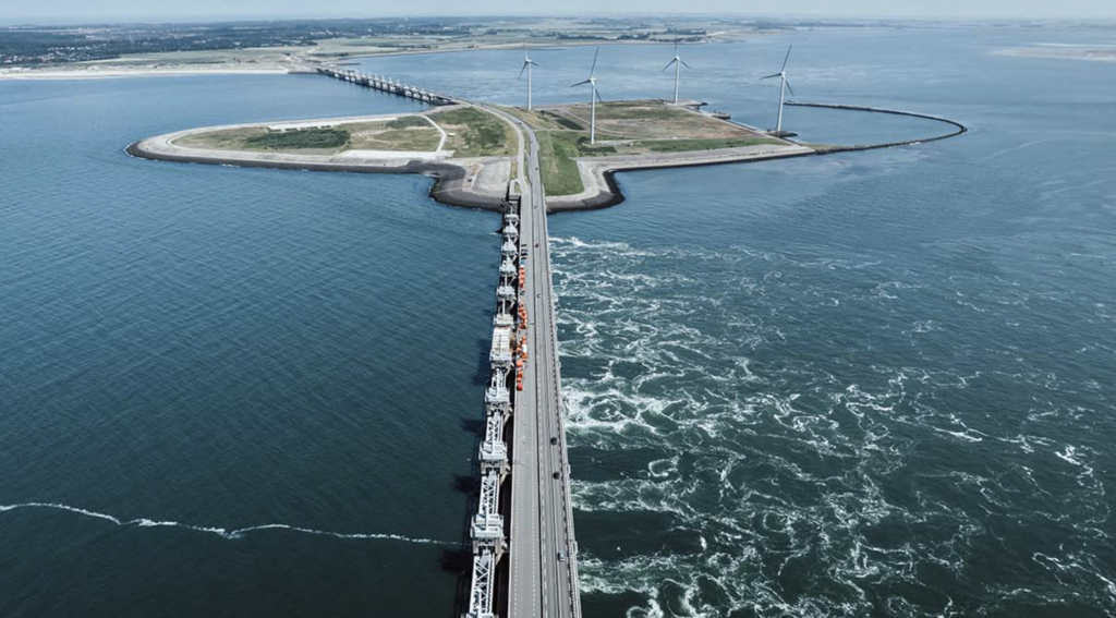
Ideas very like these options, prioritising technical advice, are currently under consideration by West Norfolk politicians for the future of The Wash. However, The Netherlands shows us that decisions about landscapes are never purely technical. The future of The Wash cannot simply be determined by adopting approaches developed elsewhere. It requires a response that recognises its own particular qualities: its scale, ecology, communities, histories and sense of place.
Compared with this Netherlands Delta region, where Rotterdam alone has a population of 650,000 people, the Wash in both Lincolnshire and Norfolk, has a very low population and little industry. No town has more than 45,000 inhabitants, and only King’s Lynn has a main-line railway station. Patterns of land ownership are very different, with much that is either private or in public trusts or Crown Estate. There are both family-owned and large agribusiness farms in both counties. The RSPB has major bird reserves, the Wildlife and Rivers Trusts are active on extensive lands, the National Trust has a growing interest. Over both counties there are few roads, none of them major, but that is what has kept the whole area largely protected and special. It is all substantially rural. Furthermore, the areas of salt marsh are known to provide an important element of natural sea-defence already.
The decisions facing The Wash are not only technical questions about flood defence or land management. They are cultural questions about what kind of landscape we want this to remain, and what forms of human activity are compatible with its environmental character.As pressures on coastal landscapes increase, there is a need for many different kinds of knowledge to come together: ecological expertise, scientific research, local experience, engineering understanding—and creative imagination.
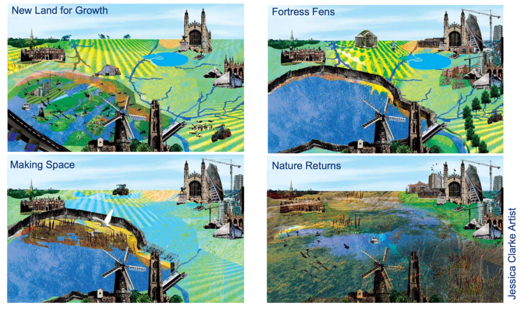
Artist impressions by Jessica Clarke of potential strategies for Fenland flood defences. Commissioned by Asher Minns, following van Alphen, J.; Haasnoot, M.; Diermanse, F. Uncertain Accelerated Sea-Level Rise, Potential Consequences, and Adaptive Strategies in The Netherlands. Water 2022,14,1527. https://doi.org/ 10.3390/w14101527
Why art matters
This is where GroundWork Gallery believes creativity has an important role to play. For ten years, GroundWork has explored relationships between art, materials and the environment. Through exhibitions and its artist residency programme, the gallery has brought artists into dialogue with landscapes, resources and communities. The next stage of this work focuses on The Wash—not as a backdrop for artistic activity, but as a complex living environment requiring imagination, conversation and care.
The future of The Wash will inevitably involve difficult choices. Climate change, rising sea levels and increasing pressure on coastal landscapes mean that decisions will need to be made about adaptation, protection and how communities live with water.
The Netherlands offers an example, appropriate to their environment, of how societies are confronting these challenges. But these choices are not only technical decisions; they are also cultural ones. They involve questions about what kinds of landscapes people value, how communities wish to live, and what futures they want to create.
The same questions are beginning to emerge around The Wash. Environmental organisations, scientists, engineers, landowners and policymakers all have essential roles. But alongside this expertise, there is another form of knowledge: the ability of artists and communities to imagine possibilities, express relationships with place and create shared understanding.
The future of The Wash cannot be shaped entirely by science and engineering. It also requires cultural imagination.
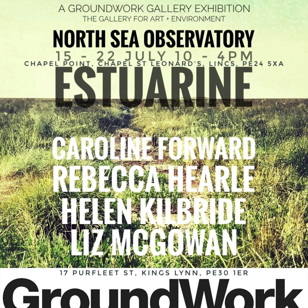
The Power of the Local
GroundWork Gallery’s forthcoming project, The Power of the Local, builds on our artist residency programme and brings together artists, communities and partner organisations from across the Wash Estuary.
Working with environmental organisations, heritage groups, community organisations and creative partners, we aim to explore the many ways people connect with this landscape: through wildlife, fishing, farming, food, industry, history, science and everyday experience.
Artists will work alongside local knowledge holders and communities, creating opportunities for workshops, conversations, performances, exhibitions and new artworks. The intention is not to impose an artistic identity upon the region, but to reveal and celebrate the creativity already present within it.
The project asks:
What kind of life do we want to see thriving in the Wash Estuary now and in the future—for humans and for the many other forms of life that depend upon this landscape?
How can creative practice contribute to the ways we think, plan and make decisions about the future?
How can we develop a culture that values environmental health while enabling communities and future generations to flourish?
These are not questions with simple answers. But they are questions that need imagination as well as expertise.
The Wash has always been a place of movement and transformation. Tides reshape its shores, birds cross continents above it, rivers carry histories through it, and communities continue to adapt alongside it.
Our hope is that through art and creativity we can help more people see The Wash not as an overlooked edge of the country, but as a place of extraordinary value, beauty and possibility.
Veronica Sekules
References
https://www.caitlingreen.org/2015/06/prehistoric-evolution-lincolnshire-coastline.html
van Alphen, J.; Haasnoot, M.; Diermanse, F. Uncertain Accelerated Sea-Level Rise, Potential Consequences, and Adaptive Strategies in The Netherlands. Water 2022,14,1527. https://doi.org/ 10.3390/w14101527
This influential article summarised options for potential response strategies, which in brief were: 1) Protect-Closed strategy: strengthen hard engineering, including sea walls, dikes, pumping stations, supplemented with sand dunes and vegetation, 2) Protect-Open strategy: maintain dikes and defences and allow some water through inlets, controlled by pumping stations 3) ‘Living with Water’ strategy: continue to use land at risk, but provide emergency flood shelters, buildings on stilts and mounds, adaptive agriculture 4) Retreat from the Coast strategy: moving away to higher land, or 5) Advance strategy: extend the coast out into the sea and enable more industry, farming and habitation.
It was referred to by Asher Minns, ‘The Fens Economy and Climate Change’, talk delivered to BCKLWN 16.12.2025